Directional Drilling in Hampton Roads
A metro that is mostly harbor — the world's largest naval station, a working port on every shore, transatlantic cables coming ashore at the beach, and a water table you can find with a shovel. Hampton Roads HDD is tidewater engineering in the Navy's home waters — and it's ours.
HDD is the whole job here
Hampton Roads is what happens when a metro grows around one of the world's great natural harbors: seven independent cities arranged on the water rather than around a downtown, with the roadstead itself — the Roads — as the region's true center. The ground is pure tidewater coastal plain: marine sands and soft clays stacked deep, organics where the old marshes lie buried (and openly, toward the Dismal Swamp's peat country), no rock at any depth a utility will ever visit, and a water table so shallow that every pit in the region is a dewatering plan first. Drilling here is soft, wet, and honest about it — buoyancy math, engineered pits, and fluid discipline are the local grammar, and quoting tidewater like piedmont is how outsiders donate schedules to the bay.
The clients define the market as much as the ground does. The Navy's presence is the region's spine — the world's largest naval base, the shipyards, the air stations — and with it comes federal-facility coordination as a standing scope line: access, escort, security requirements, and utility work that serves missions rather than schedules. The port braids through everything else, and at the oceanfront a quieter giant: Virginia Beach's transatlantic cable landings have made the city a genuine intercontinental fiber gateway, with landing-station connectivity and the terrestrial routes it feeds forming a fiber market most metros this size never see.
And the water is rising — this coast leads the East in recurrent flooding, and the region has answered with resilience programs that keep hardening, elevating, and undergrounding work in permanent rotation across every city's capital plan. Behind it all sits the network desk — 50,000+ boring calls answered, ~10,000 crossings quoted, 2,000+ drilled — pricing tidewater scope with the water table already in the math.
Fiber-Optic Boring
Cable-landing backhaul, base-adjacent duct, and FTTH across the seven cities.
Electrical Duct Boring
Resilience conversions, port and shipyard feeders, and coastal-grade hardening.
Water & Force-Main Boring
Pressure pipe for seven city systems in ground that's already half water.
Elizabeth River & Tidal Crossings
The signature Hampton Roads bore: under the working water that is the metro's middle.
Road & Highway Crossings
Seven cities' streets, VDOT's edges, and the tunnel-approach corridors.
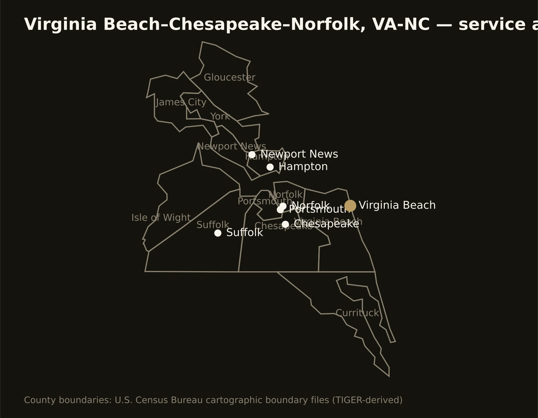
The seven cities and their tidewater ring — Virginia Beach's oceanfront-to-Pungo sprawl, Norfolk and Portsmouth facing off across the Elizabeth, Chesapeake reaching to the Dismal Swamp, the Peninsula's shipyard shore, and the rural water-country edges into North Carolina. Full county list on the service-area page.